A Brief History of Fisheries in the River Tawe and Swansea Bay (updated Feb 2023)
by Ray Lockyer, Life President and Secretary
Fisheries of the Lordship of Gower
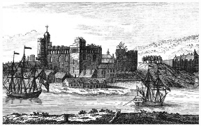
Following the battle of Hastings in 1066, it took the Normans nearly forty years to reach and conquer the region subsequently known as the Lordship of Gower[1]. The boundary to the west was divided from the Lordship of Cydweli by the River Lougher. From the Lougher, the boundary ran along Cwm Cathan, over the hills beneath Penller Castell to Garnant; then along the River Amman and across to the River Twrch, which divided Gower from the Lordship of Brecon; and so to the junction of that river with the Tawe. The eastern border of Gower with the Lordship of Glamorgan followed the Tawe downstream to Glais. The Manor of Kilvey, east of the lower Tawe, extending from the seashore to the Glais and Crymlyn streams was a separate appendage governed with Gower. By the year 1106, with the Normans in firm control of Gower, Henry I granted the Lordship of Gower and Kilvey to Henry de Beaumont, 1st Earl of Warwick; de Beaumont built Swansea Castle, to serve as the base (or caput) for the lordship.
Swansea Castle from the south-east side 1741 on the engraving of Samuel and Nathaniel Buck
Henry de Beaumont’s grandson got heavily into debt with the crown, and King John I repossessed the Lordship in part settlement of the outstanding liability, and subsequently granted it by Charter to William de Braose in 1203.
The Lordship continued with the Braose family until the death of William de Braose, 2nd Baron Braose in 1326, with no surviving sons. To settle the inheritance of his property whilst alive, he had dividing his lands between his daughters, Alina and Joan. The Lordship of Gower went to Aline (the eldest), and her husband Sir John de Mowbray. In 1334, Edward III confirmed these earlier grants. At the end of the 14th century, Thomas de Mowbray (Aline’s successor) became 1st Duke of Norfolk. Following the death of John de Mowbray, 3rd Duke of Norfolk, on account of the young age of his son (and heir), in February 1462 Edward IV committed the custody of the Lordship of Gower and Kilvey into the care of William Herbert, the Earl of Pembroke. In March 1465, John 4th Duke of Norfolk was given his lands. But Lord Herbert remained in control of Gower probably as the duke’s tenant. In 1468 the Duke of Norfolk conveyed his Lordship of Gower and Kilvey to Lord Herbert; the conveyance was subsequently confirmed by Edward IV in 1469. In 1492 Sir Charles Somerset married Elizabeth Herbert and in 1514 Sir Charles was made Earl of Worcester; the hereditary Lordship of Gower and Kilvey remained in the Somerset family from that time. A direct descendant was made Duke of Beaufort in 1682.
W.C.Rogers, writing about the Port of Swansea in Stewart Williams’ Glamorgan historian, Volume Five[2] records that: “King John gave Swansea to William de Braose in 1203 as part of ‘Totam terram de Guher’, this word terram connoted not merely the land of Gower, but all its foreshore too, from ‘Pulcannon’ to ‘Logherne’ which is to say from Pwll Cynon in Crymlyn Bog to the junction of the Lougher and Amman rivers, inclusive of the beds of the Tawe and Loughor rivers”.
The full text of the 1203 Charter[3] reads as follows:
“Johannes Dei gracia Rex Anglie Dominus Hibernie, Dux Normannie, Aquitannie et Comes Andegavie: Archiepiscopis, episcopis, abbatibus, comitibus, baronibus, justiciaribus, vicecomitibus, ballivis et omnibus ministris et fidelibus suis, salutem. Sciatis nos dedisse concessisse et presents carta nostra confirmasse dilecto et fideli nostro Willelmo de Braosa totam terram de Guher cum omnibus pertinenciis suis in Wallia. Habendam et tenendam sibi et heredibus suis de nobis et heredibus nostris per servicium unius militis pro omne servicio. jure volumus et firmiter precipimus quod predictus Willelmus de Braoso et heredes sui post ipsum habeant et teneant totam predictam terram de Guher cum omnibus pertinenciis suis in Wallia de nobis et heredibus nostris per predictum servicium sicut predictum est bene et in pace libere et quiete integre plenarie et honorifice cum omnibus libertatibus et liberis consuetudinibus suis in omnibus locis et omnibus rebus ad predictam terram pertinentibus. Hiis testibus: Baldewino comite Albemarlie; Willelmo de Humet, constabulario Normannie; Radulpho Tacone, tunc senescallo Normannie; Roberto de Harecurt; Hugone de Gornaco; Johanne de Pratellis; Petro de Stokes. Datum per manum Hugonis de Well’ apud Rothomagum. xxiii die Februarii anno regni nostri quarto.”
Added below this is the following writing in Norman-French, with marginal title — Ija chartre de la terre de Goulier. E les bundes . dc ineime la terre. (Charter of the Land of Gower and its boundaries…):
Logherne va desques a Amman e parte la terre de Govhek e la terre de OARNEWALDHAr . Amman parte parentre Gtouher e Iskennyn et le Commod p’uED desques a Lleuenedh. E Lleueneth desques a Claudhoweyn. E Claud- HOVFEVN desques a Tourthe. Tourthe departe entre Gtouher et la terre de
Breckeneu desques a Tawy. Tawy departe entre Gouher e la terre le coimte de Gloucestrie desques a Aber Gleys . [De] Gleys . desques a MEYNHiRYON . De Meynhirion . desques a Crimelyn . De Crimelyn . desques a Pulcanan . De Pulcanan desques a Neth . desques a la Meek . et cetera.
James M. Burton[4] provides the following interpretation of this Norman-French charter description of the boundaries of the Lordship of Gower:
“River Logherne (Loughor) as far as the Amman separates the land of Gouher (Gower) from the land of Carnewaldhar (Carnwyllion). Amman separates Gower from Iskennen (Iscennen) and the commote of Perfedd as far as the Lleuenedh (Llynfell). Along the Llynfell as far as Claudhoweyn (Clawdd Owen), and Clawdd Owen as far the Tourthe (Twrch). Twrch separates Gower from the territory of Brecknock (terre de Breckeneu). Tawe separates Gower from the Earl of Gloucester’s land (le conte de Gloucestrie, ergo Glamorgan)”.
(Note: Carnwyllion was one of the hundreds that formed Carmarthenshire; a hundred or cantred/cantref (plural – cantrefi) was a medieval Welsh land division and this cantref was located between Kidwelly and the River Lougher. Whilst Iscennen was a subdivision or commote of Cantref Bychan where Carreg Cennen Castle still dominates the horizon.)
This grant by King John included all the lands of Gower, all the beds of those rivers that formed its boundaries and it also means the grant by the king in 1203 deprived the public of their right to fish the foreshore and in the tidal waters: Alderman Edward Harris, in his book entitled ‘Swansea’[5] describes on page 94 the ancient fisheries in the Tawe: “In present days, the discoloured and polluted waters of the Tawe make it almost beyond belief that fish could ever have lived in it, much less that it was ever a fisherman’s paradise, as reputed. The Exchequer MS, however, show that before 1231, at the latest, John de Breus, Lord of Gouher, had granted to the Monks of Neath Abbey a moiety of two fisheries in his waters of Tawy ‘whereof one lies near Swansea Castle and the other at Horegrove, where the Memroth stream falls into the Tawy’. The records also show the monks were granted another fishery in the Tawe at Ynisymond above Glais.
In 1686 there were four fishing weirs upon the salt sands opposite to St. Thomas chapel, within the Manor of Kilvey, which were held by Bussey Mansel at rentals payable to the Lord of the said Manor. The survey of Kilvey taken in that year states that one of these weirs had been lately erected upon a new foundation, and that no freeholder of the Manor could set up any weirs or engines or device for the taking of fish without the consent of the Lord.“
‘Swansea’ also provides further detail on page 128 of fishing weirs in the bay: “At that time and until very recent times, and probably by reason of ancient grants from the Lords of the Seigniory, who were entitled to and had retained the right of taking all fish from the bay, many of the houses in and around Swansea and also at Mumbles had attached to them as appurtenances which passed with the property a weir or weirs situated between high and low water marks in the bay upon which they had the right to erect stake nets, and thus obtain their own supplies of fish”. (Interestingly enough, the traps used on the foreshore of Swansea bay were, according to J.Geraint Jenkins in ‘Nets and Coracles’[6], of a distinctive design having very long V-shaped wicker wings with a basket trap attached at the apex. Wooden stumps that remain from these structures are still to be seen during low water of spring tides in the bay).
Michael Gregory writing in ‘Angling and the Law’[7] on the rights of the public to fish in tidal waters states: “The public has no right to fish in any non-tidal waters, on the other hand, the public has a right to fish in all tidal waters, except where their right was lost before the Magna Carta, 1215, by the King granting fishing rights to a subject“. The signing of the Magna Carta was the first legal impediment imposed upon a King of England by a group of his subjects (his feudal barons), it was an attempt to limit his powers by law and protect their rights; it effectively preventing the King from depriving the public of such fishing rights. Clearly all the fishing rights in the River Tawe downstream of the confluence with the River Twrch at Ystalyfera were at one time in the ownership of the Somerset estate including, because of the grant by King John in 1203, those in the tidal estuary and the foreshore.
During the reign of Henry VIII the Laws in Wales Acts 1535 and 1542 were passed and principality was divided into twelve counties. The Act extended English law to Wales, abolished the historical Lordships either merging them into either new or existing counties and many of the rights of the Marcher lords were abolished; the Lordship of Gower was incorporated into the county of Glamorgan[8]; however, the hereditary title and the lands of Gower were retained by the Somerset family and described in detail in the Gabriel Powell’s 1746 “Survey of Gower”[9]. In more modern times, much of the lands continue to be held by the Somerset Trust. A direct descendant of Sir Charles Somerset became the Duke of Beaufort in 1682.
A dispute concerning ownership of section of the Tawe occurred in 1756 and the details have been well documented by Prys Morgan[10]. This altercation has been referred to as the ‘Glais Boundary Dispute’ and it centred around two insignificant little brooks, the Cyrnach and Glais, which formed part of the ancient boundary between the lordships of Cadoxton and Kilvey. As we have seen above, since the Middle Ages Kilvey had been controlled by the Lords of Gower; consequently, the protagonists were Gabriel Powell, Steward of the Lordship of Gower and Kilvey and one Thomas Edwards, Steward of the Lordship of Cadoxton. Powell, having made an extensive study of the charts and grants of the land in the area owned by the Duke of Beaufort stoutly maintained that the boundary of Kilvey lay on the northern bank of the brooks; whilst Edwards attempted to establish that it lay at the centre line of their beds. On the 17th May 1756 Edwards and party, representing the owners of Cadoxton, set off to mark the boundary, in the way that was traditional of the times, by placing stones along the centre line of the brooks. Starting at the very source of the Cyrnach, working down its valley to the point where it joined the Glais Stream; then proceeding down the Glais to its confluence with the River Tawe at the village of Glais. To counter the claim, Gabriel Powell and his supporters did all that they could to obstruct the passage of his opponents along the route being disputed by both groups. On reaching the village of Glais, Thomas Edwards made it clear that the owners of Cadoxton made no claim to the River Tawe except for fishing rights in half of Glais Pool and Llyn Ymwn (the name Ymwn has been associated with Ynysymond). Cadoxton’s title to these fishing rights can be traced to the grants made by the Norman Lords of Gower to the monks of Neath Abbey. Now the Lordship of Cadoxton bordered on the Tawe between the Glais Brook and Nant Llechau (at Alltwen) and Thomas Edwards was by this statement acknowledging the fact that the eastern bank and not the centre of the river constituted the boundary between the two lordships. All of which tends to confirm what we already know of King John’s grant of the Lordship of Gower to William de Braose.
The claim by Edwards, on behalf of Cadoxton, to two fisheries in the River Tawe at this location provides something of an inconsistency, as all the evidence indicates only one fishing wear was granted to the monks in this area. This single fishery was confirmed by Edward III in 1334 whilst affirming earlier grants; it included details of the fishery being confined to a region of forty perches above and forty perches below a weir (220 yards above and 220 yards below) and this was at Ynysymond[11].
In 1449, John ap Griffith ap Howell had a water driven corn mill at Ynispenllwch[12]. and paid the Lord of Gower the sum of twelve pence for his water supply from a weir in the “Water of the Tawe near Enespenllogh”. Some two hundred years later in 1647 an iron foundry was built at Ynyspenllwch, probably on the site of the corn mill, this also used water from a weir in the river. Today the Vale Clydach (Mond) Refinery covers the site of the mill, and the only remnants of the earlier works is the mostly dry, leat from the weir skirting the western boundary of the Glais golf course. The location of the weir was situated just downstream of what is known to present day anglers as the Coal Pool, Ynysymond. Note: the name Ynyspenllwch means the island at the head of the lake” (deriving “llwch” from the Irish “lough”)[13]. It is reasonable to conclude that this was the likely location of the earlier site of the monks fishing weir as it was near the lower reach of Llyn Ymmwn that is shown on a map[14] drawn up in 1600 – 1602 at the behest of Sir John Herbert the then owner of the Lordship of Cadoxton. See 1602 map and later 1927 conveyance map.
Following the earlier ‘Glais Boundary Dispute,’ club files show that in June 1760 the Steward for the Lordship of Gower produced a “Statement of His Grace the Duke of Beaufort’s Title to the River Tawey in the County of Glamorgan and Evidence to Support it“[15]. The statement demonstrates from the number of references to leases and rents for fisheries in the Tawe, many applying to freeholders with property bordering upon the river, that they were being run as ‘Several fisheries’ owned by the Duke of Beaufort, some existing in the estuary and on the foreshore. The entry of 1746 records the renewal of a lease to one Lockwood Esquire for the fishing from Forrest Bridge to the sea. The statement also records other occasions when title to the Lordship of Gower’s the fisheries on the River Tawe were challenged by individuals. For example, in 1752, a Thomas Popkin of Ynystawe & Fforest[16] inherited land on both sides of the river at Forrest, he immediately made claim to the river and the fishery where it passed through his property. To defend his title the Duke of Beaufort instigated legal proceedings against Popkin. In March 1755, the dispute came to trial at Hereford where the Court found judgement in favour of the Duke.
The report of the Royal Commission into Salmon Fisheries (England and Wales)[17] produced in 1861, provides a substantial amount of information about the fisheries on the River Tawe, it was mainly collected from four individuals: Messers George Harry, Matthew Moggridge, William Thomas and Trevor Adams Williams. From the evidence presented, the fishery on the river was being adversely affected by trapping, netting, liming, spearing, groping, sledge hammering, mine water, tin works, saw mills and all manner of other activities. Williams and Moggridge were rod and line anglers of the period and conversant with fly fishing; despite being ‘brothers of the angle’, even they were prepared to exploit the river and salmon and sea trout ‘pink’ (smolt) fishing without any close season was an accepted practice. There being very little control of any description. Interestingly enough a rod licence for England and Wales was being discussed by the Commission and a price tag of ten shillings (50 pence) or one pound was mentioned – perhaps we should not complain too loudly about the cost of fishing today! Another tidbit from the report is that the young seatrout were known as ‘skirlings’; a name I would prefer to the current colloquial term of shoalie or schoolie used in the valley.
In 1927 the Trustees of the Will of H.N. Miers purchased from the Tenth Duke of Beaufort the freehold of all the Fishery, soil and bed of the Rivers Tawe and Clydach[18] where they joined or passed through the lands belonging to the Ynispenllwch Estate which were all located to the west of the River Tawe. The Miers family were for some considerable time the owners of Ynispenllwch and events leading up to the sale (including from letters held in the club archives) would indicate that the title to the rivers had been the subject of an ongoing dispute between the two parties. It is of interest to record that although the Ynispenllwch Estate acquired the whole of the riverbed and fishing rights, their land ownership only extended, except on part of the River Clydach, to the one bank of these rivers. It is also worth noting here that in the court case Rice v. Dodds[19], Mr Justice Plowman held that a fishing path along the bank is to be implied on the grant of fishing rights if the rights cannot be exercised without it. Also available on file in the club archives are letters from the Duke of Beauforts’ Glamorganshire Estates Office in April 1927 confirming the inclusion of “the soil and bed of the whole River Tawe adjoining the Ynispenllwch Estate” i.e. precisely what we understand of the original grant by the King in 1203. The title plan attached to the 1927 Conveyance also clearly illustrates that the whole of the bed of the River Tawe adjacent to the estate was included in the purchase.
A conveyance dated 30th September 1933 shows that Mr R. Stuart Kirkhouse purchased “a portion of the bed and soil of the River Tawe at Trebanos in the County of Glamorgan”[20] from the 10th Duke of Beaufort. The conveyance plan shows this portion of the riverbed was the whole bed that abutted the Ynys-Y-Mond Isaf Farm on the eastern bank of the river and clearly demonstrates it was not included Mr. Kirkhouse’s original farm title. Now Ynys-Y-Mond Isaf Farm is in an area that historically formed part the Lordship of Cadoxton where it bordered on the Lordship of Gower with the River Tawe and this again indicates the eastern bank, and not the centre line of the river, formed the boundary between the Lordships. In 2000 the Society purchased the fishing rights in this section of the river from the beneficiaries of the estate left by Mr R. Stuart Kirkhouse.
Both of the above conveyances again support what is known of the John I grant to William de Braose in 1203 and the Duke of Beaufort’s title to the whole bed of the River Tawe between the estuary and the confluence of the River Twrch.
Further support for the Duke of Beaufort’s title to the river bed is provided by reports in national newspapers at the beginning of 2009 that City & County of Swansea had paid the duke £280,000 for an easement to construct a bridge across the river (also reported by the Mail on Line)[21].
In 1954 the then Pontardawe Angling Society obtained a lease to the Ynispenllwch fishery and for the next thirty years members fished from both banks of the river, erected styles and notices; all without let or hindrance from anyone. (Copies of the 1954, 1960 and 1968 leases are in club archives). In 1983 the Society underwent a name change and became known as Pontardawe & Swansea Angling Society. Over this period, a section of the Ynispenllwch fishery was sold to the then International Nickel Company (INCO) and in 1984 the Society purchased the freehold title to the remainder which included the River Tawe at the Cemetery Pool, (Llyn Ymmwn) Trebanos, the Junction Pool at Clydach and virtually all of the Lower Clydach River from the Junction Pool upstream to the Lone Bridge. Even this purchase has not been without its problems; British Waterways making claim to the fishing on the western bank of the Junction Pool at Clydach, but reference to the 1794 Act of Parliament which permitted the construction of the Swansea Valley Canal[22] persuaded them of their folly – see correspondence. The Act contains several clauses for the protection of Duke of Beaufort’s fishery in the River Tawe and no provision can be found which would have allowed the canal promoters to obtain title. The owners of Llwyndu Farm on the eastern bank of the Cemetery Pool also created some difficulty when the purchase was ongoing but must have been advised of the weakness of the claim and in the near 40 years that have passed since the purchase, they have not pursued the matter and members continue to fish the area without hindrance. Each year since the purchase, in the time-honoured tradition, your secretary and members have walked (and fished) unchallenged on the eastern bank of the Cemetery Pool to clearly mark the boundary of the Society’s rights at this location and long may it remain so.
(Note, Ynisymond, Ynysymond and Ynys Y Mond; similarly, Ynispenllwch, Ynyspenllwch and Enespenllogh are all the different spellings I have found in documents when researching the above history.)
References:
[1] Lordship of Gower – Wikipedia
[2] W.C. Rogers; The Port of Swansea, (in Stewart Williams’ Glamorgan historian, Volume Five).
[3] The Public Record Office, a.R. MisrF,i.L. Books, Vol. I.) dated 4 John 23 February 1203 was transcribed by George Thomas Clark and published in his Cartae, vol.2, pp. 287–8 (1910): Cartae et Alia Munimenta Quae ad Dominium de Glamorgancia Pertinent.
[4] James M. Burton, Palleg – Tribal Lands, Manor & Farm Estate’ wrote about the Jurisdiction of Brecknock Manor 1093-1283
[5] Alderman Edward Harris; (1935), Swansea, Western Mail & Echo Ltd, pp. 94.
[6] J.Geraint Jenkins; (1974), Nets and Coracles, (ISBN 9780715365465), David & Charles,.
[7] Gregory, Michael; Angling and the Law; 1974, ISBN 13: 9780853142119
[8] The Statutes at Large of England and of Great Britain from the Magna Carta to the Union of the Kingdoms of Great Britain and Ireland Volume III (page 250)
[9] Gabriel Powell’s “Survey of Gower” in 1746 [G Powell, Survey of Gower”, B. Morris (Ed), Gower Society, 2000, ISBN 0 902767 27 5]
[10] Prys Morgan, The Glais Boundary Dispute (in Stewart Williams’ Glamorgan historian, Volume Nine).
[11] Held in club archives is a certified copy of a “Statement of His Grace the Duke of Beaufort’s Title to the River Tawey in the County of Glamorgan and Evidence to Support it” June 176
[12] Brian S. Taylor; (2008); The Watermills of the Lordship of Gower; (ISBN 978-0955902406); Brydor Publishing
[13] Christy Davies; (1982); (Clydach); The Journal of the Gower Society; Volume 33
[14] The Parish of Llansamlet” Compiled and produced by T.E. Stradling, Swansea 1999.
[15] Held in club archives is a certified copy of a “Statement of His Grace the Duke of Beaufort’s Title to the River Tawey in the County of Glamorgan and Evidence to Support it” June 176
[16] Thomas Nicholas; (1872); Annals & Antiquities of the County Families of Wales; Volume 2; Longmans, Green, Reader. Pp. 584
[17] Report of the Commissioners Appointed to Inquire into Salmon Fisheries (England and Wales) 1861 (pages 79 to 85 – a hard copy held in club archive)
[18] Held in club archive is the original “Conveyance of part of the soil and bed of the River Tawe between His Grace the 10th Duke of Beaufort and Edward Colvill Lyons & others” (Trustees of the Miers, Ynispenllwch Estate) dated 29th September 1927.
[19] Rice v. Dodds; (1970) 213 E.G. 759 cf.
[20] Held in club archive is a certified copy of a “Conveyance of portion of the soil and bed of the River Tawe at Trebanos in the county of Glamorgan between His Grace the 10th Duke of Beaufort and R.S.Kirkhouse Esq.” (Ynysymond Isaf Farm) dated 30th September 1933.
[21] Duke charges taxpayers to build footbridge over riverbed
[22] Swansea Canal Act 34, George III on May 23, 1794 (page 65; CXI)