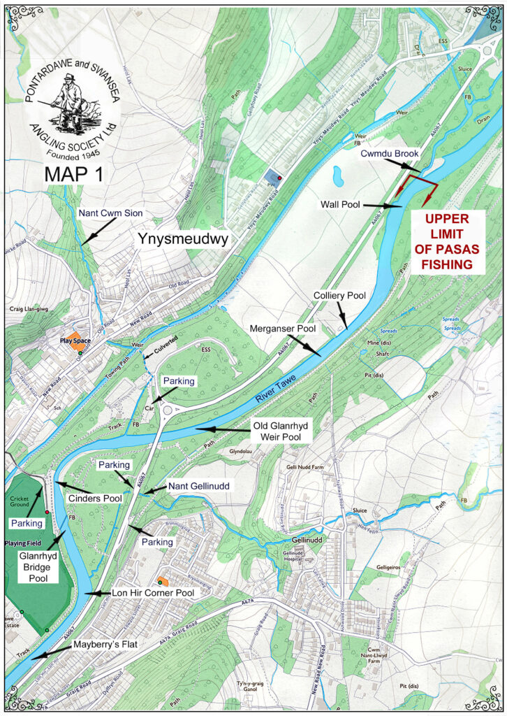
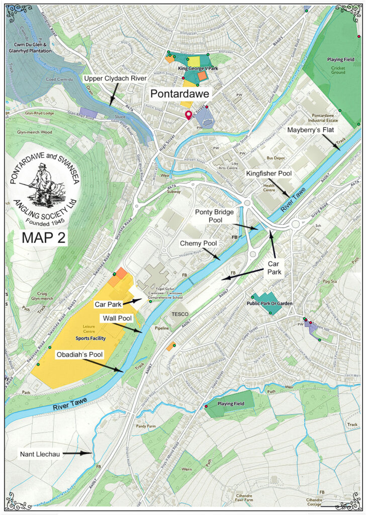
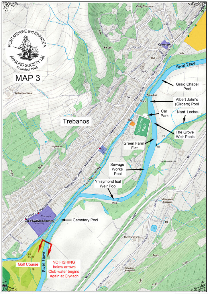
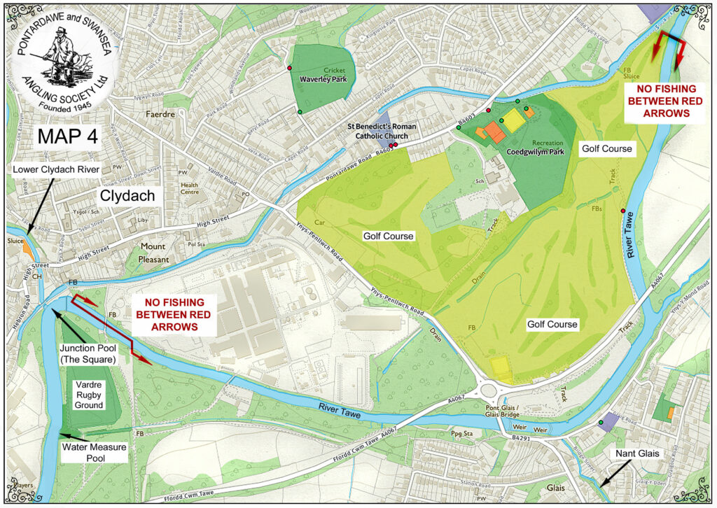
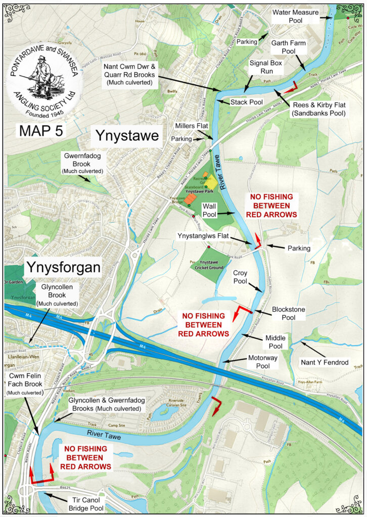
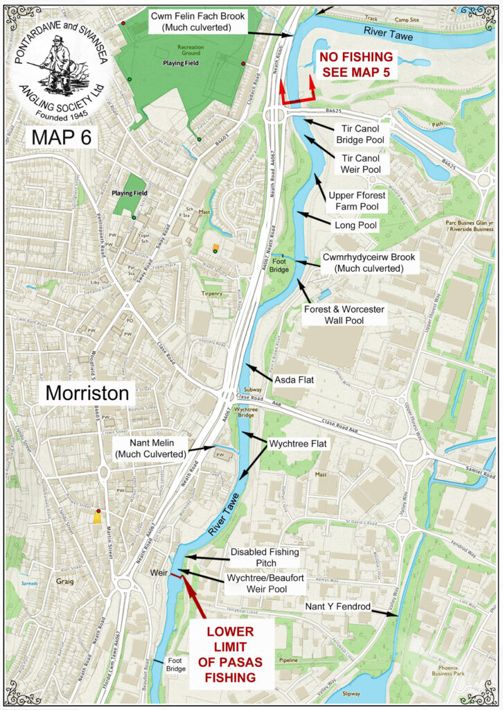
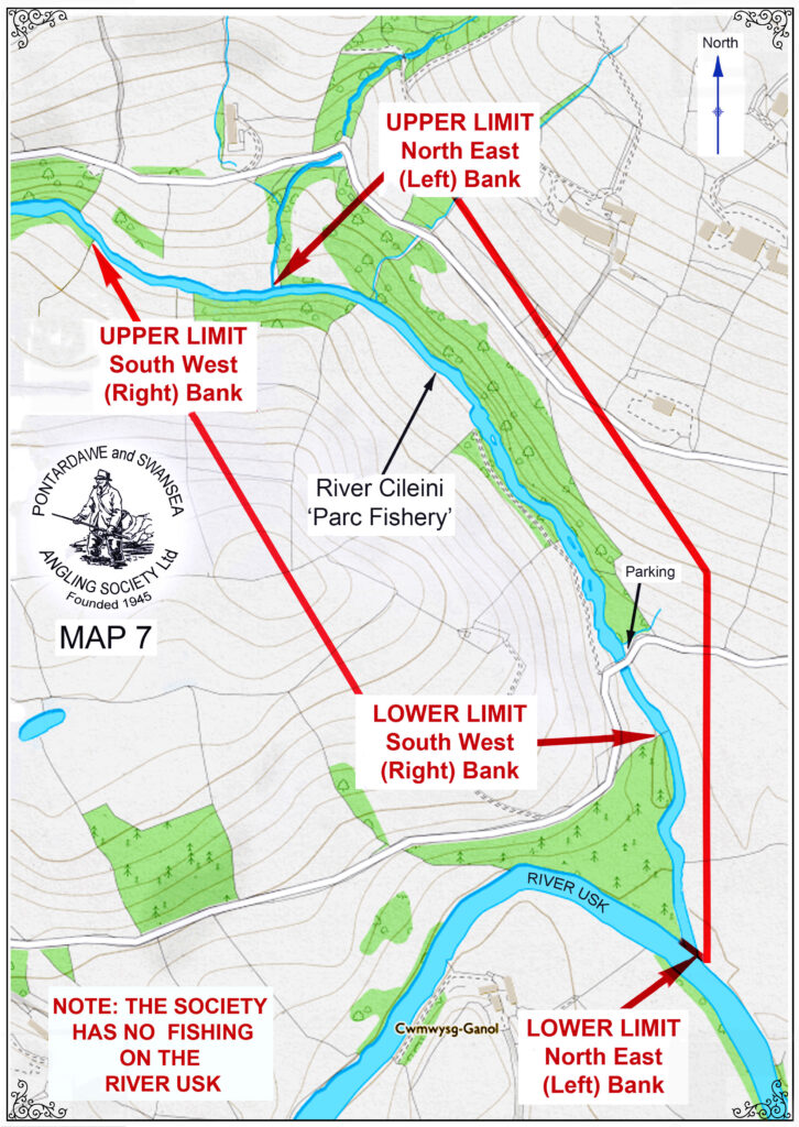
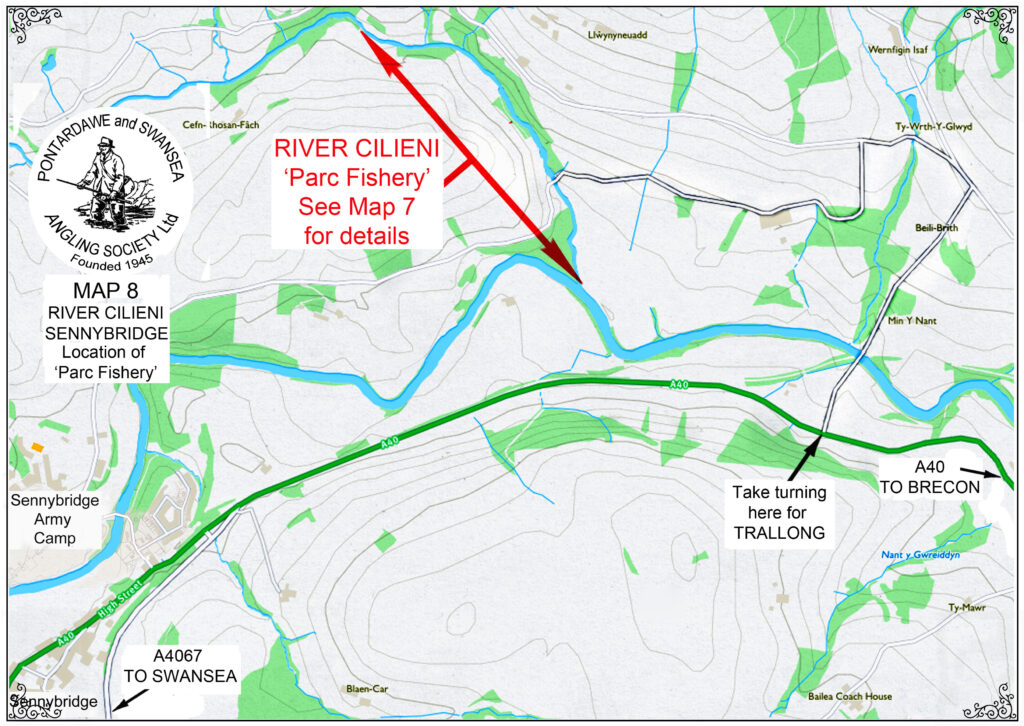
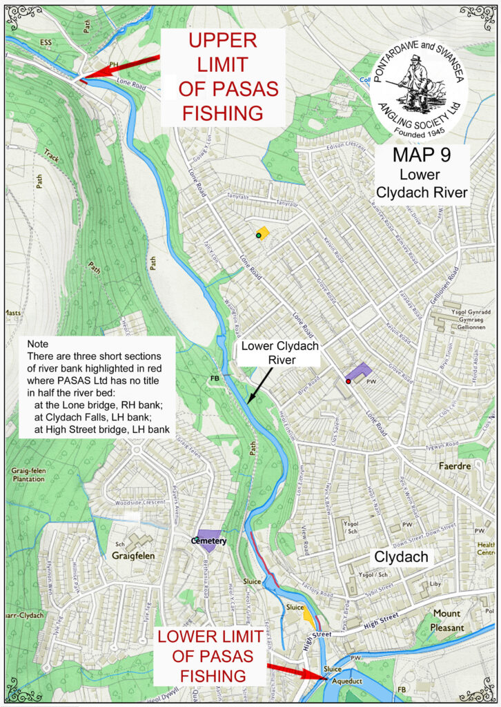
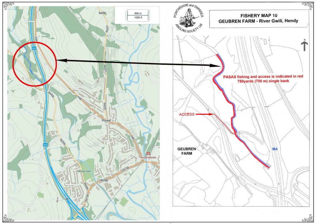
These maps break up our water on the Tawe into 6 sections, numbered 1 to 6 from the top down. Our water on the Cilieni is on Maps 7 and 8. That on the Lower Clydach is Map 9. That on the Gwili is on Map 10.
To download all the maps as a single printable file, click here…
![](https://pasas.uk/wp-content/uploads/2023/08/FisheryMap1-Ynysmeudwy-2020-726x1024.jpg)
![](https://pasas.uk/wp-content/uploads/2023/08/FisheryMap2-Pontardawe-2020-728x1024.jpg)
![](https://pasas.uk/wp-content/uploads/2023/08/FisheryMap3-Trebanos-2020-726x1024.jpg)
![](https://pasas.uk/wp-content/uploads/2023/08/FisheryMap4-Clydach-2020-1024x726.jpg)
![](https://pasas.uk/wp-content/uploads/2023/08/FisheryMap5-Ynystawe-Ynysforgan-2020-726x1024.jpg)
![](https://pasas.uk/wp-content/uploads/2023/08/FisheryMap6-Morriston-2020-726x1024.jpg)
![](https://pasas.uk/wp-content/uploads/2023/08/FisheryMap7-Cilieni-ParcFishery-2020-726x1024.jpg)
![](https://pasas.uk/wp-content/uploads/2023/08/FisheryMap8-Cilieni-Location-2020-1024x726.jpg)
![](https://pasas.uk/wp-content/uploads/2023/08/FisheryMap9-LowerClydach-2020-726x1024.jpg)
![](https://pasas.uk/wp-content/uploads/2023/08/FisheryMap10-Geubren-Farm-2023-1024x726.jpg)